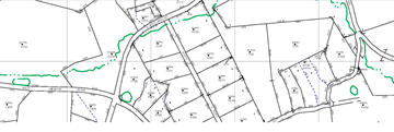
Welcome To Geographical Information Systems
Welcome To Geographical Information Systems
Mission
The Berks County Geographic Information Systems (GIS) Office's mission is to develop, implement and support countywide GIS and mapping applications, standards and products. The GIS Office also strives to provide education about the effective and efficient use of GIS technology to support good planning and sound decision making by all county agencies.
NOTICE:
The Information Systems Department will be performing system maintenance resulting in intermittent outages for various County systems including County GIS Applications and Services during this timeframe:
Saturday, April 6, 8:00am to Sunday April 7 5:00pm
GIS Information


Your Guide to Common Processes and FAQs
Information / Resources
Links
Pennsylvania Spatial Data Access (PASDA) - Pennsylvania GIS Data Clearinghouse
Federal Emergency Management Agency - FEMA Flood Map Service Center
Pennsylvania Department of Conservation and Natural Resources (DCNR) GIS
Pennsylvania Department of Environmental Protection (DEP) GIS
Pennsylvania Keystone GIS (PAMAGIC)
Pennsylvania Map Program - DCNR Bureau of TopoGeo - PAMap Program
Pennsylvania Department of Transportation (PennDOT) PennShare Portal
County GIS Professionals Association of Pennsylvania
United States Geological Survey
United States Census Bureau - Geography
Environmental Systems Research Institute (ESRI) - GIS Software
FAQs
YES, GIS data and other County data and documents are now being provided on the Berks County Data Hub. You may browse by different subject matter and can download datasets and information in various formats. All publiclaly available datasets are now housed here and the County has discontineud the sale of GIS products in 2022.
The County also provides various web mapping applications that allow you to interactively view things such as property details and ownership, as well as dashboards and story maps. Web Mapping Applications.